Detailed Satellite Image Maps of Greater Ranges
NEW EDITION 2013, extensively revised
K2 and Baltoro Glacier 1:80 000, the map of the whole basin of Baltoro and the whole range of Baltoro Muztagh. Satellite SPOT 4, resolution 10 m, data via Geosystems-Polska, all map composition by Grzegorz Glazek.
2ND EDITION 2013, updated and thoroughly revised (e.g. about 60 % more objects added, trek trails updated), published by Master Topo in June/July 2013.
(First edition by PZA, Polish Mountaineering Association see >>)
K2 and Baltoro Glacier 1:80 000, the map of the whole basin of Baltoro and the whole range of Baltoro Muztagh. Satellite SPOT 4, resolution 10 m, data via Geosystems-Polska, all map composition by Grzegorz Glazek.
2ND EDITION 2013, updated and thoroughly revised (e.g. about 60 % more objects added, trek trails updated), published by Master Topo in June/July 2013.
(First edition by PZA, Polish Mountaineering Association
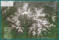
1:100 000 of the Mount Everest and surrounding area, including Cho Oyu, Makalu, Rolwaling Himal with Gaurisankar, Ama Dablam, Cholatse, Tamserku, Mera Peak, Baruntse. Satellite Landsat 7, ground resolution 15/30 m, data via Geosystems-Polska, all map composition by Jan Zurawski.
Published by Fabryka Reklamy in Nov 2004
(with some partnership of MasterTopo and PZA).


